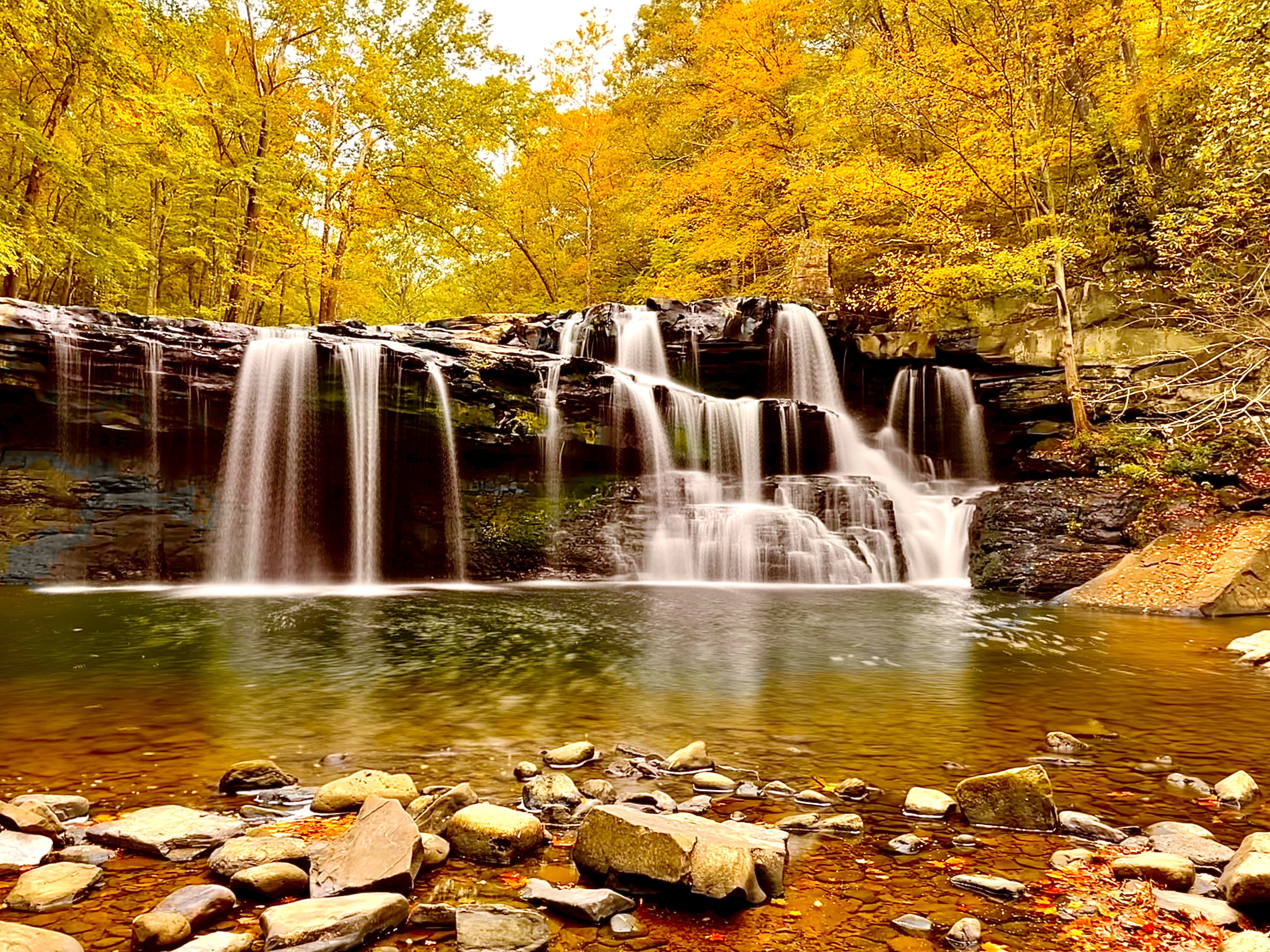
Height: 33 feet
Trail Type: Dirt and rock
Hike Distance: 1/2 mile round trip
Difficulty: 4
Beauty: 8
Overview:
Brush Creek Falls is a popular area between Princeton and Beckley, West Virginia. It’s surprisingly big, as pictures and video don’t really do it justice. The creek here is wide and the rock falls away immediately to allow the water to free fall down.
Directions:
From Interstate 77 in West Virginia, take exit 14 if you’re coming from the south and exit 20 if you’re coming from the north. From exit 14, turn right onto Mercer Springs Road and then the first left onto Eads Mill Road. Drive 3.3 miles down the narrow road and turn right onto Brush Creek Falls Road. You should see signs for Brush Creek State Park. The parking area with a picnic shelter will be less than a 1/2 mile down the road.
From exit 20, you’ll turn right onto US 19 south and take the first left onto Eagle Crest Road. Drive 3.7 miles and turn left onto Brush Creek Falls Road.
Hike Description:
The hike to the overlook to Brush Creek Falls is pretty easy, just be careful not to trip over an exposed rock. If you want to get down to the base, keep walking past the overlook and pick one of 3 scramble trails down to the base (the 3rd and final trail down is the easiest).
If you’d like to stay in the area, the smaller White Oak Creek Falls is about a mile farther down the trail.
