Height: 150 feet
Trail Type: Gravel, dirt, and rock
Hike Distance: 1.2 miles round trip
Difficulty: 15
Beauty: 10
Overview:
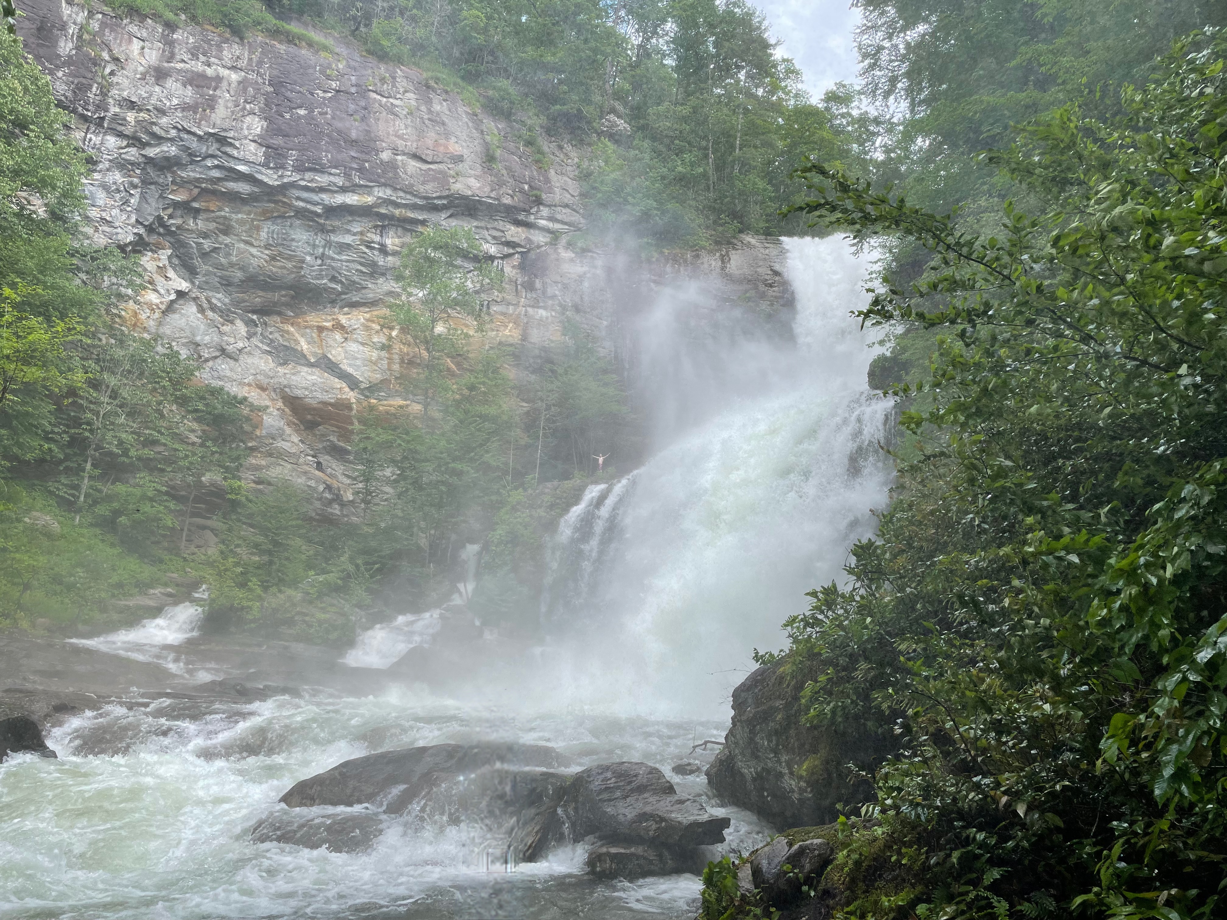
I know the ratings are supposed to be on a 1-10 scale, but High Falls is going to be the exception. Maybe I wasn’t hydrated enough. Maybe I was grossly out of shape (this is the likely issue). But this is a trail I’ve decided I will never do again despite how wonderful this waterfall is.
High Falls is fed by the dam at Lake Glenville, so flow can be practically minuscule OR, as above on the dam release days, it can be spectacular. It’s also known as Cullowhee Falls for some reason, even though the town of Cullowhee is almost 30 minutes away. If you do go see this waterfall (and I’ll admit that it’s totally worth it as a once-in-a-lifetime thing), check the dates for the releases.
Directions:
From the intersection of US 64 and NC 107 in Cashiers, head north on NC 107 for 6.4 miles and turn left onto Pine Creek Road. The road winds up the ridge before coming out at the end of the lake and over the dam just above Onion Falls (there’s no view, but would be equally as impressive as High Falls). The parking area is 2 miles from the intersection on the right.
Hike Description:
Kayakers use this trail to drop in for the rapids that are created on dam release days, so as difficult as it is going down, know that people can do it while also carrying a kayak.
The trail is downhill 99% of the way, which means it’s uphill 99% of the way back. It loses almost 600 feet of elevation, and there are almost 700 rock steps to get down to the bottom. THIS. TRAIL. IS. HARD.
It begins as gravel for the first quarter before turning to dirt and increasing the decline grade. Take your time and you’ll be fine. Once you get to the rock steps, you’ll keep winding your way down to a spot at the base. If the river is raging like it was on the day I went, the spray will make it difficult to get pictures or video.
